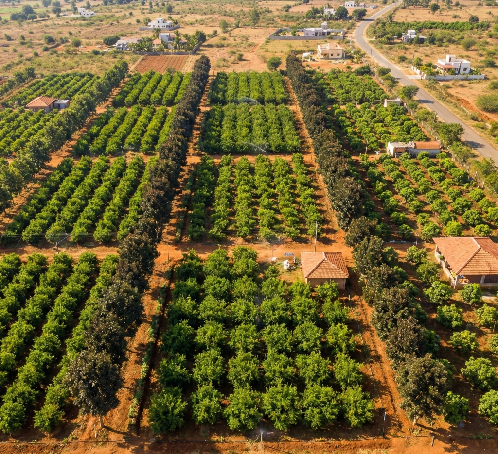
Premium Managed Farmland Near Kanakapura
Escape the city traffic to the green corridors south of Bangalore. Managed agriculture and clear land titles.
Why the Kanakapura Corridor?
Kanakapura Road (NH-209) is one of Bangalore's most rapidly developing arteries, shifting from a quiet suburban highway to a bustling real estate hotspot. However, just beyond the city limits (past Harohalli), the landscape opens up into beautiful, fertile agricultural belts.
For Bangalore residents (especially those in Jayanagar, JP Nagar, and Banashankari), the Kanakapura corridor offers the fastest exit trajectory out of the city into pristine nature. This accessibility makes farm plots in this region incredibly desirable for weekend homes and managed farms.
Highway Widening
The four-laning of NH-209 has drastically reduced travel times from South Bangalore.
Water Resources
Proximity to the Cauvery river basin ensures better water tables for agricultural development.
Weekend Tourism
Close to trekking spots, resorts, and waterfalls.
The NH-209 Execution Cycle
For decades, Kanakapura Road was considered a tedious, congested exit out of South Bangalore. The ongoing National Highway Authority of India (NHAI) four-lane widening project of NH-209 has fundamentally rewritten this narrative.
Crushing Commute Times
The widening from the NICE Road junction all the way to Kanakapura town is nearing completion. This infrastructure upgrade transforms what used to be a grueling 90-minute drive into a smooth, high-speed 40-minute commute.
As the commute shortens, the effective distance of farmland along this corridor shrinks. Families in JP Nagar, Jayanagar and Banashankari can reach a farm here in less time than many North Bangalore drives.
The Metro Connection
Coupled with the highway expansion is the fully operational Namma Metro Green Line terminating at Silk Institute. Serving as a massive transit hub, it anchors the northern end of Kanakapura Road, ensuring high-density urban infrastructure stops precisely where the expansive, green agricultural belts begin. You get the perfect intersection of Tier-1 city transit and pure rural isolation.
The Cauvery Basin Advantage
While East and North Bangalore grapple with severe groundwater depletion and thousands of dry borewells, the Southern corridor tells a dramatically different ecological story.
Natural Geographical Shields
The Kanakapura belt lies squarely within the Arkavathy catchment area and is heavily influenced by the Cauvery river basin. The geology here consists of ancient granitic gneiss overlaid by deep red laterite soils, which are exceptional at retaining moisture.
Because this corridor is shielded by the massive Bannerghatta National Park to the east and the robust river networks to the south, the static water levels are significantly healthier than the rest of the IT capital.
Cauvery Stage V Impact
Furthermore, the upcoming commissioning of the BWSSB Cauvery Stage V water supply project (slated to deliver 775 MLD to South Bangalore) has a profound secondary effect on farmland. As residential layouts along Kanakapura road reduce their dependence on deep borewells, the regional aquifer naturally recharges. When you buy farmland south of Kanakapura, you are buying into one of the better-watered farmland corridors near Bangalore.

Managed Farmland on Kanakapura Road
Complete titles on every current project. Walk the land with our team before you decide.
Kanakapura Road is its own corridor
This guide covers Kanakapura only. Hosur/Thalli and North Bangalore are separate corridors. For the current project quote, see the farmland cost guide. Current managed farmland in the South corridor (Thalli and Kanakapura) from ₹25L / ₹250 per sq.ft.
The Green Buffer
The primary fear of any farmhouse owner is urban encroachment. You buy a quiet acre of land, and five years later, a noisy cement factory or a massive apartment complex is built right next door.
The Bannerghatta Shield
Kanakapura Road is unique because its eastern flank is heavily protected by the Bannerghatta National Park and its associated eco-sensitive zones. State zoning regulations strictly prohibit dense, polluting industrial development in this corridor to protect the wildlife and forest cover.
This regulatory "Green Buffer" helps protect the long-term quiet of your farm. It ensures that the air quality remains pristine and that your weekend retreat actually feels like a retreat, rather than just a suburb of Bangalore.
Retail and Social Infrastructure
Despite this protected green cover, the residential development closer to the city (JP Nagar, Kumaraswamy Layout) has pulled high-end retail down the corridor. You have access to premium international schools, massive retail centers like Forum Mall South, and super-specialty hospitals like Apollo and Fortis. You enjoy the absolute silence of the forest with Tier-1 city amenities just a 30-minute drive away.
Agronomy on Kanakapura Road
South Bangalore's agricultural heritage is deeply rooted in high-value horticulture and sericulture. The specific microclimate of the Kanakapura corridor, heavily influenced by the surrounding forest, makes it an incredible zone for specific crops.
The 'Gajina' Soil Profile
The local farmers refer to the soil here as 'Gajina Mannu'—a gravelly red soil that drains water almost instantly while holding onto essential macronutrients. This soil profile is the absolute holy grail for Mango cultivation.
At our managed estates, we leverage this soil by planting Ultra-High Density (UHD) Mango orchards. Unlike traditional planting distances, UHD orchards fit more trees per acre than traditional spacing.
Sandalwood & Long-Term Timber
Beyond seasonal horticulture, the security of the Kanakapura corridor makes it ideal for high-value timber. Our agronomists heavily favor Indian Sandalwood (Santalum album) and Malabar Neem in this region.
Kanakapura Farmland FAQs
What is managed farmland in Kanakapura?
Managed farmland in Kanakapura is fully-serviced agricultural land where a management company handles all farming operations — soil preparation, drip irrigation, crop planting, security, and harvest. You own the land title directly. The One Acre Farms manages plots along Kanakapura Road and the Harohalli corridor, focusing on coconut, timber, and inter-cropping.
Are there farm plots available in Kanakapura?
Yes, managed farm plots are available in the Kanakapura-Harohalli corridor south of Bangalore. Current One Acre Farms managed farmland in the South corridor (Thalli and Kanakapura) starts from ₹25L / ₹250 per sq.ft. Plot totals depend on size and project. Plots include perimeter fencing, drip irrigation, 3-phase electricity, and internal farm roads.
Is Kanakapura Road a good place to buy farmland?
Yes. The Kanakapura belt (NH-209) in South Bangalore is highly sought after for weekend homes and farm plots due to its proximity to the city, excellent four-lane connectivity, and proximity to natural reserves like the Cauvery Wildlife Sanctuary.
Are there managed farmland projects near Kanakapura?
Kanakapura Road, including Harohalli, is its own South Bangalore corridor. It is not Hosur/Thalli and it is not North Bangalore. For the current project quote, see the farmland cost guide. Current managed farmland in the South corridor (Thalli and Kanakapura) from ₹25L / ₹250 per sq.ft.
What is the distance from Bangalore city to Kanakapura?
Kanakapura is approximately 55-70 km from central Bangalore, depending on your starting point. The drive takes 1.5-2 hours via NH-209 (Dommasandra Circle to Kanakapura Town).
What documents should I verify before buying farmland in Kanakapura?
Essential documents include: (1) 30-year Encumbrance Certificate, (2) FMB (Field Measurement Book) sketch from the survey department, (3) RTC (Record of Rights, Tenants, and Crops) or Pahani, (4) Khata certificate and extract, (5) title deed and parent documents, (6) zoning verification. Both Karnataka and Tamil Nadu allow free purchase of agricultural land — documentation requirements apply to both states.
Can non-agriculturists buy farmland in Karnataka near Kanakapura?
Both Karnataka and Tamil Nadu now allow any Indian citizen to purchase agricultural land without restrictions. Karnataka's previous restrictions on non-agriculturists have been amended. We recommend consulting a registered legal advisor before purchasing farmland in either state. Managed farmland here is Kanakapura, in Karnataka. It is not a Tamil Nadu project and it is not near Hosur/Thalli.
What crops are grown on farmland near Kanakapura?
The Kanakapura region supports a variety of crops including ragi, paddy, coconut, mango, banana, tomato, and mulberry. The red loamy soils and adequate rainfall make it suitable for both food crops and commercial plantations. Our managed farms in the region focus on coconut, timber (teak, mahogany), and inter-cropping.
Is there good water availability for farmland near Kanakapura?
The Arkavathy River and its tributaries provide decent groundwater in the Kanakapura taluk. Most farmland plots have borewell access at 200-500 feet depth. Rainfall averages 800-1,000 mm annually. Our managed farms use drip irrigation and farm ponds to manage water through the dry months.
Ready to explore farmland on Kanakapura Road?
Schedule a free consultation. We'll walk you through the South corridor and your plot options.
Finding farms that match...